
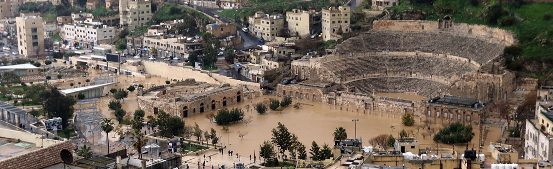


Exposure & Sensitivity

WP 3 analyzes the spatial and temporal impacts of flash floods on humans, infrastructure, and ecosystem services. Exposure or spatial occurrence encompasses the hazard analysis due to flash floods. Sensitivity determines the potential for damage in areas affected by heavy rainfall. We conduct an innovative integrated vulnerability analysis of flash floods, with the identification, mapping, and assessment of flash flood hazards, as well as an analysis of the damage potential resulting to the determination of risk.
Sub-work packages:
Hazard analysis (Exposition)
For the hazard analysis (spatial occurrence/exposure), GIS analyzes, and hydrological and hydraulic modeling are performed. At the watershed level of the selected study regions (Amman and Petra), a GIS analysis of terrain low points and flow paths is conducted. For each study region a small catchment area is then selected together with the Jordanian partners to condcut a detailed, small-scale modeling. The modeling of hydrological and hydraulic processes requires a profound data basis comprising hydrometeorological data sets, land use, slope, soil properties, and information about the infrastructure such as profiles of roads, flow obstacles and culverts. For model validation, the results for past heavy rainfall events will be compared to observed flooding and damages.
Damage potential (Sensitivity)
The analysis of damage potentials (sensitivity) requires the mapping and economic assessment of infrastructure, land use and ecosystems, and possibly ecosystem services in the affected area. The latter is conducted in close collaboration with the Jordanian partners using quantitative and qualitative assessment approaches.
Identify and assess flash flood risk (Climate impact)
The hazard analysis and the analysis of damage potentials are combined for the preparation of risk maps and assessments. This will lay the foundation for the vulnerability analysis and the allocation and implementation of adaptation measures in WP 5. The risk maps will also be used as a basis for risk communication (WP 6), so that targeted warnings of hazards and risks can be issued to selected target groups accordingly.